Published at 890 × 516 in The quick guide to South Africa
Data source: Statistics South Africa Census 2011
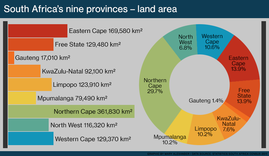
Bar graph and pie chart comparing the land area of South Africa’s nine provinces. The provinces are the Eastern Cape, Free State, Gauteng, KwaZulu-Natal, Limpopo, Mpumalanga, Northern Cape, North West and Western Cape.